
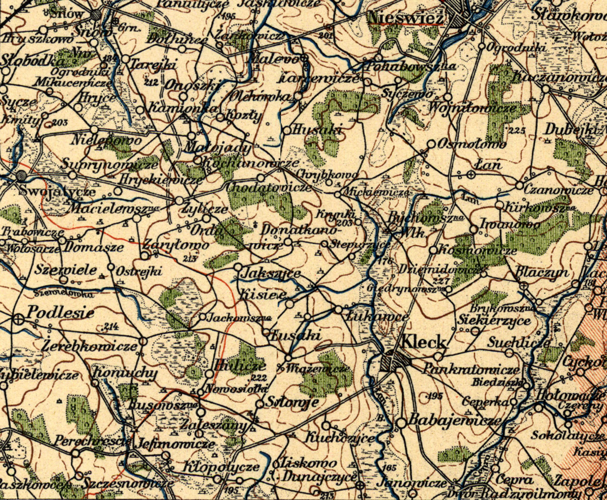
This map was obtained from the Stanford University Branner Earth Sciences Map Library, whose support of research by members of the public is notable and warmly acknowleged.
This is a portion of a 1929 map series published by Wojskowy Instyut Geograficzny. Similar maps are available from military/ government sources. At least one adjoining map in this series at Stanford was an original marked with a Wehrmacht (German Army) stamp, underlying the historic significance of these maps. Were these very maps used to plan the invasion of Poland or elements of the Holocaust?
The orientation of this map is conventional: North is at the top. It shows an area approximately 32km (20 miles) across and 26km (16 miles) deep.
This section happens to occupy the lower left of the original map sheet, and thus the area shown is somewhat arbitrary. Does this area approximate the local mind-set of a typical Kletsk resident in that era? Certainly those in professions requiring travel routinely circulated over a larger region.
|
|
 |
KehilaLinks Home | JewishGen Home
This page is hosted at no cost to the public by JewishGen, Inc., a non-profit corporation.
If you feel there is a benefit to you in accessing this site, your JewishGen-erosity is appreciated.
Compiled and Created by Henry Neugass
| Contact: |
Last Updated: HDN 05-Mar-2023 11:29
Copyright © 2023 Henry Neugass