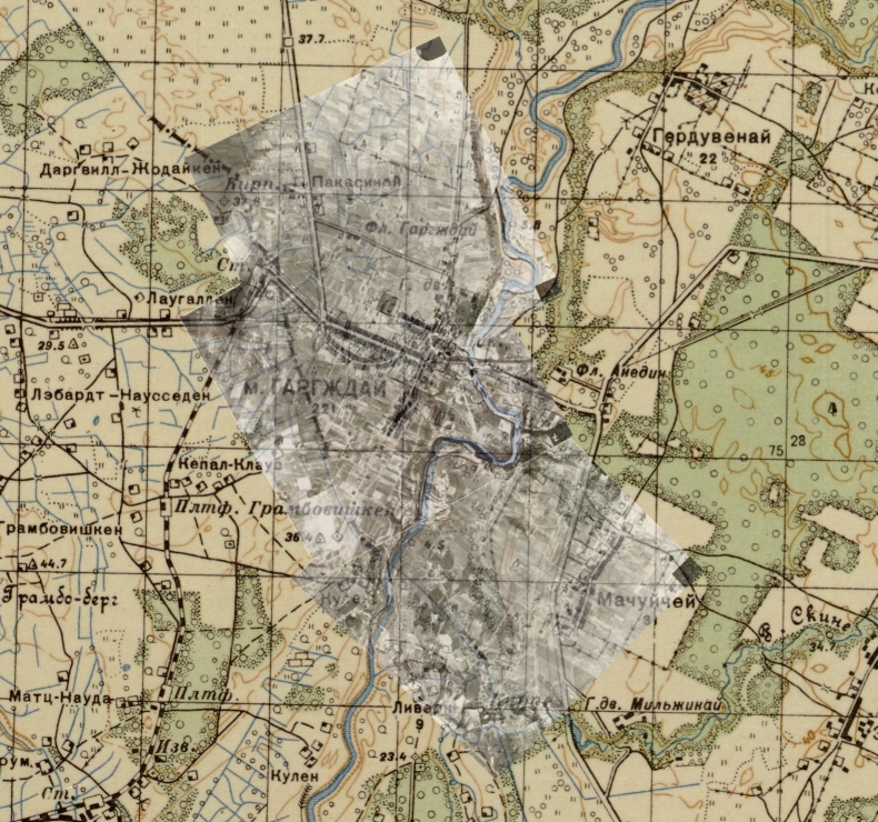
Comparison of Three Aerial Photographs and 1910 Russian Military Map
This animation compares the three overlapping Aerial Photographs taken in January, 1945 (# 156, 157 and 158), and the 1910 Russian Military map (1:50,000). ID numbers on the photos increased as the reconnaissance plane plane flew northwards. (Some firewall or ad-blocking settings may block this .gif animation, and it may not be visible with some operating systems or devices.)
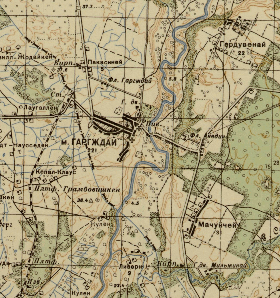
The three photographs just miss Anielin ("Anelishke")
east of the Minija River, which is shown on the map. This is the
site where the Jewish women and children of Gorzd were held captive until
killed in September, 1941.