
BIALYGen
Bialystok Region Jewish Genealogy Group
GRODNO GUBERNIYA POLAND IMAGING PROJECT
SURVEY OF JEWISH CEMETERIES
by Heidi M. Szpek, Ph.D.
Associate Professor, Department of Philosophy and Religion Studies
Central Washington University
May 2007
Partial funding provided by: The Department of Philosophy & The Office of International Studies and Programs Grant Committee,
Central Washington University, Ellensburg, Washington 98926, USA
Back to Poland Imaging Project Cemeteries Index
|
Narew GPS: 52°55'N 23°32'ESize: c. 1 acre Number of matzevoth: <20 Bagnowka.com: Narew Gallery (photographed in 1989; 1991)
Image 1
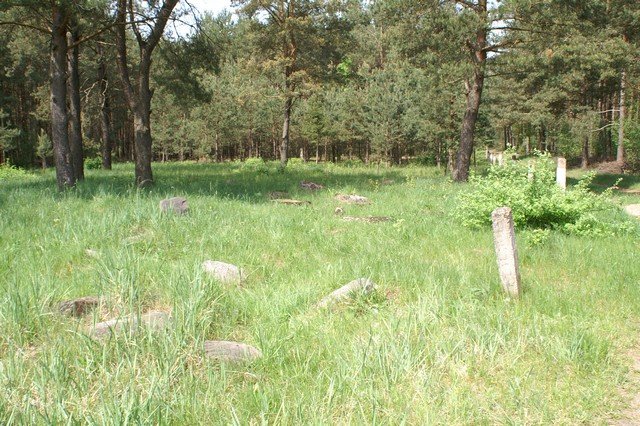
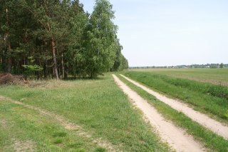
Directions: The cemetery is a little difficult to locate as it is off the highway in an open area surrounded on three sides by pine forest. From Bialystok, take highway 19 south 20 km to Zabludow. In Zabludow, take county road 685 at left (southeast) for 23 km to the town of Narew. The cemetery is actually just outside of the southwestern edge of the city. On the smaller county road from Bialystok to Hajnowka, BEFORE the village of Makówka, the cemetery will be off of a dirt forest road on your right (west). This small road is just opposite a small auto repair shop (Image 2). (IF you pass the sign indicating the town of Makówka, you’ve gone too far. Turn around and look for the auto shop (now) on your right and dirt road at left.) Travel about 1 km on this dirt road into and through the pine forest. The small cemetery will appear in a clearing at right (with a road that goes back to the county road (Images 3-5). The cemetery is bounded on three sides by pine forest; at left will be an open farmer’s field.
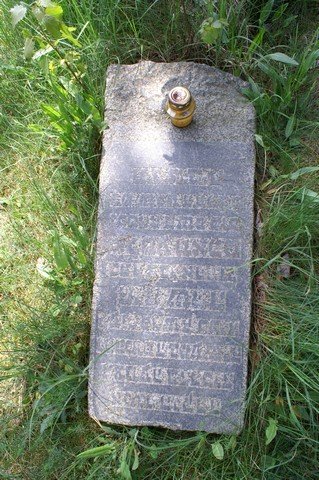
Conditions: The cemetery is well-protected by the natural shield of pine forest on three sides. Evidence of some fence/wall structure is indicated by concrete posts that surround the cemetery (posts are not identical). The cemetery is about an acre in size. On entering, nine matzevoth lay together (having been returned to the cemetery – Image 1). One matzevah is in situ at the front of the cemetery (Image 7). Twelve supports are extant toward the front; a few supports toward the back (Images 4-6). A total of 12 matzevoth with inscriptions were counted (examples in Images 7-10), some broken. A few stones are overturned and may preserve inscriptions. No threats to cemetery are evident, excluding the natural progression of the elements.
Image 7
Back to Poland Imaging Project Cemeteries Index
|
||||||||||||||||||